
When people first see one of my 3D topographical maps, the usual reaction is something like: “Is that carved metal?” “Is it 3D printed?” “How is that made?” The honest answer is: it sits somewhere between sculpture, model-making, metalwork, and map-making. A cold cast metal 3D map is a physical raised-relief map made using real terrain data, a handmade mould, resin, and genuine metal powder. The finished piece has the appearance and feel of aged metal, but it is produced without traditional foundry casting or molten metal. At Mountain Castings, I use this process to create detailed 3D maps of mountains, lakes, coastlines, walking routes, and meaningful places around the world.
So, what does “cold cast metal” mean?
Cold casting is a technique where fine metal powder is mixed with resin and cast into a mould. Because the process happens at room temperature, rather than using molten metal, it is known as cold casting. The outer surface of the map contains real metal powder, such as bronze, copper, or aluminium-based silver finishes. Once cured, the piece can be polished, aged, darkened, highlighted, and finished by hand to bring out the terrain detail. This gives the map a metallic appearance and a much more substantial feel than a standard plastic 3D print.
Is it the same as a 3D print?
No — and this is an important difference. A 3D print is usually the starting point, not the finished product. For many of my maps, the process begins with digital topographical data. That data is used to create a highly detailed 3D terrain model. From there, a master model is produced, refined, and used to make a silicone mould. The final map is then cast by hand from that mould. So while 3D printing can be part of the process, the finished piece is not simply a printed plastic model. It is a cold cast object with a real metal surface, hand-finished to bring out the shape, texture, and relief of the landscape.
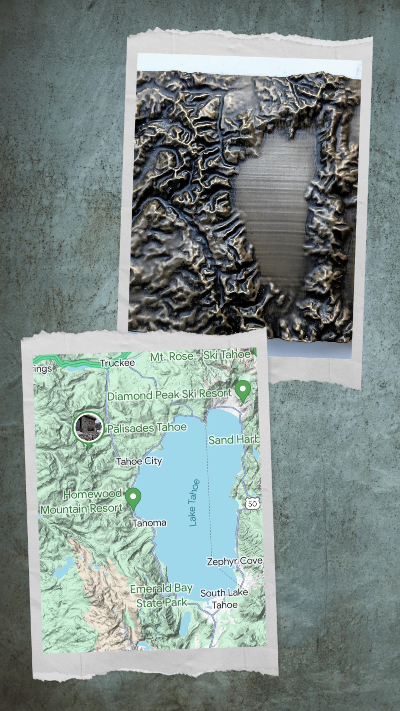
Why use real terrain data?
The beauty of a 3D topographical map is that it shows the actual shape of the land. Instead of looking at contour lines on a flat map, you can physically see and feel the ridges, valleys, summits, passes, lakes, and coastlines. This is especially powerful for mountain areas. Places like the Lake District, K2, Snowdon, Ben Nevis, Everest, the Coast to Coast route, or any meaningful walking route become much easier to understand when shown in three dimensions. A flat map tells you where somewhere is. A 3D map shows you what it feels like.
Why does the finish matter?
The finish completely changes the character of the piece. Aged bronze gives a traditional, timeless feel. It suits classic mountain landscapes, walking routes, and heritage-style interiors. Copper has a warmer, richer look. It works particularly well where the map is intended to stand out as a feature piece. Silver has a cleaner, more modern appearance and can suit sharper, contemporary spaces. Because each piece is finished by hand, no two maps are exactly identical. The patina, highlights, shadows, and final surface character all vary slightly, which is part of what makes the process worthwhile.
Is a cold cast map solid?
Yes. These are solid physical objects, not hollow display shells or thin printed plaques. The exact construction can vary depending on the size and design of the map, but the aim is always to create something strong, durable, and satisfying to handle or display. For framed pieces, the map is mounted and presented ready to hang. Smaller pieces can also be made for shelves, desks, or tabletop display.
Why choose a 3D map instead of a normal print?
A normal map or photograph can be beautiful, but a 3D map does something different. It captures the physical form of a place. That makes it especially meaningful for:
- a mountain someone has climbed;
- a walking route someone has completed;
- a lake or valley connected to family memories;
- a favourite national park;
- a honeymoon, expedition, race, challenge, or special location;
- a custom map of a home area or meaningful landscape.
It becomes less like a picture and more like a small piece of the place itself.
Can any location be made?
In most cases, yes. Because the maps are created from terrain data, custom pieces can usually be made for locations around the world. Mountains, islands, coastlines, lakes, national parks, routes, and local landscapes can all work well. Some areas have better available data than others, and some landscapes are naturally more dramatic in relief, but the basic idea is simple: Choose the place, and I turn the shape of that land into a physical 3D object.
Handmade in Cumbria
Mountain Castings is based in Cumbria, surrounded by the kind of landscape that first made these maps feel worth making: fells, lakes, ridges, passes, and long-distance walking routes. Every map is made through a hands-on process involving digital mapping, model preparation, mould making, casting, finishing, ageing, and framing. It is a technical process, but also a craft process. The data gives the map its accuracy. The hand-finishing gives it its character.
Final thought
A cold cast metal 3D map is not just a map and not just a decorative object. It is a way of preserving the shape of a real place — a mountain climbed, a route walked, a landscape loved, or somewhere that matters. That is what makes the process special.